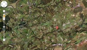
 Use Google Earth (or Google Maps if you haven’t got to grips with Google Earth!)
Divide the class into groups and give each group a location. (You can use the line or path function on Google earth to do this)
Give the class a series of tasks or questions. The less able group might be given tasks such as
- Find at least one farm
- Find two natural features (a river, a hill etc)
- Find two different sorts of houses
- Write down two place names
A more able group could be given harder tasks such as
- How many farms can you find?
- How many different natural features can you spot?
- Can you find examples of a Victorian house, a modern bungalow and a very old building such as a church or castle? (using street view)
- Make a list of the place names in the area and find out what they mean.
- How far is it to the seaside?
Encourage the groups to use different overlays on Google Earth, to zoom in and zoom out, to use street view etc. If you want to extend the activity they could put place markers on the map to illustrate their answers.
Then compare their results. Would they describe the area they have explored as rural, urban or suburban? What are the main differences between the areas?


 English
 Nederlands
 Deutsch
 Italiano
 Español
 Português
 Română
 Cymraeg
Esta actividad es muy innovadora para primaria y también para secundaria en la que pueden tener una visión real de aquello que les pide el profesor como por ejemplo a la hora de aprender los rios es muy práctico, ya que en lugar de aprender los rios en papel pues puedes observarlos con una visión real, ampliarlos, calcular distancias, etc.
Y así con muchos otros ejercicios como el ejemplo que explican arriba de las explotaciones agrícolas.
Totalmente de acuerdo con Rosemarie, es una gran idea para la aplicación práctica de la teoría de clase. De hecho en España, ya se crearon aplicaciones que ponen de uso la geomática, para ampliar sus recursos.
Así también se puede generar en los alumnos un aprendizaje significativo y duradero, para todos los niveles educativos.
This activity is very innovative for primary and secondary. With this application students can have a real view of the landscape. Give a true picture of the landscape is interesting to promote different learning experiences, for example the students can learn the names of the rivers of Spain better than seeing in a traditional book; they can have a real vision of them, expand, calculate distances, etc.
And so on with many other exercises like the example explained above about farms.
Our current Geography curriculum also includes the study of different coastal landscapes found in different parts of Europe. After having gone through the morphological analysis of a given area, I found Google Earth particularly useful to show the students in practice how radically different for example Northern landscapes can be from the typical Mediterranean Riviera they are accustomed to. A fabulous tool to get ‘the feel’ of a place that otherwise would in most cases remain ‘theoretical data’ in the minds of many students.